Maps - Navigation
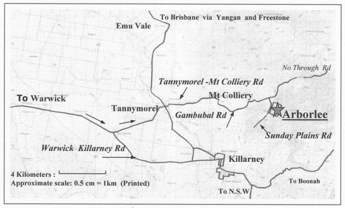
Coming from Brisbane into Warwick turn left at the first set of lights into Fitzroy St. Drive 1.2k to the end of Fitzroy St and turn right into East St. Drive 2.4k to the southern end of East St to a T intersection with the Killarney Rd then turn left onto this road. It is 18.6k along the Killarney Rd to the Tannymorel turnoff. Drive 5.7 km to Tannymorel and take the Mt Colliery turn towards the mountains. It is 5.3 km going through Mt Colliery to the right hand turn onto Gambubal Rd. It is then 6km up the mountain to the turnoff to Sunday Plains Rd. Our Driveway is 0.67km form this turn. This is a good place to ring on CDMA mobile phones to let us know if you need to be picked up from the top of our drive.
The following map is courtesy of Google Maps.
Loading of maps may take time.
Use the navigation keys (top left) to zoom in or out.
Use SATELLITE for a photo map view of Arborlee's location.
Click on red marker for more information
Home | About Us | The Forest | Photo Gallery | Bookings | Maps | Contact Us